By George, it’s one of the Penders’ hiking treasures
- Richard Philpot

- Apr 5
- 10 min read
Updated: 6 days ago
The George Hill Park-Port Washington Loop is an undiscovered North Pender Island gem. Explorers of this trail hike and road walk find a treasure trove of riches: a beautiful array of flora and fauna, spectacular panoramic views, intriguing roadside art and history, and relaxing solitude. And each of these rewards is free to enjoy. Can you search out the “LOVE-ly” goodie tucked in a Pileated woodpecker hollow?
Table of Contents
Photographs, videos, audio, and text Copyright © 2026 Richard Philpot/SGIOUTSIDE.ca.

A 220-degree panoramic view awaits hikers at the summit of George Hill Park.
GEORGE HILL PARK-PORT WASHINGTON LOOP
Walden Road/Ogden Road Trailhead
Pender Islands Parks and Recreation Commission (PIPRC)
RP’s Most Recent Visit: June 23, 2026
Overview
From the trailhead on the south corner of Walden Road and Ogden Road, this vertical trail requires a 143 metre (approx. 470 feet) climb up a combination of cleverly designed natural and manufactured steps through dense forest. Continue along a grassy ridge and a steep section to the summit—and a BIG view: a sweeping 220-degree vista encompassing the city of Vancouver, the mainland’s coastal mountains, and, scanning counter-clockwise, Mayne Island, Galiano Island, Prevost Island, Salt Spring Island, Vancouver Island, and the Olympic Mountain Range. From the George Hill East Trail’s “Arbutus Tree Lookout,” you’ll see Mayne Island, both Penders, Samuel Island, Saturna Island, and, beyond Saturna, the U.S. San Juan Islands.
George Hill Park-Port Washington Loop FACTS
Distances and elevations vary depending on the GPS tracker device and the digital mapping software used.
Best time of year: Anytime.
Difficulty Rating: STRENUOUS to the George Hill summit; MODERATE otherwise
Trail Type: Loop
Distance: 4.3 km (2.7 miles)
Time Allowance: At least 1.5 hours
Highest Elevation: 123 metres (approx. 404 feet)
Lowest Elevation: 2 metres (approx. 7 feet)
Elevation Gain: 121 metres (approx. 397 feet)
Dogs Permitted: Yes, on a leash at all times
Amenities: NO outhouses, bike racks (Ogden Road; Upper Terrace Road), four resting benches (permanent binoculars at summit bench)
Freshwater Availability: None
Parking: Three designated spots on Ogden Road, otherwise along the shoulder of Ogden Road
Trailhead Coordinates (Ogden Road): 48.81972, -123.32062
Travelling to the Trailhead: By vehicle—7.5 km (13 minutes) from Driftwood Centre (left on Bedwell Harbour Road, left on Otter Bay Road, left on Port Washington Road, right on Bridges Road, right on Stanley Point Road, left on Walden Road, right on Ogden Road; On foot—Car Stops at the corner of Clam Bay and Port Washington Roads and Port Washington Road/ Bridges Road/Paisley Road.
Birders: 99 species since 2017 (eBird)

George Hill Park trailhead (Ogden Road).
Route Description
George Hill Climb
The parking area on the south side of Ogden Road is 60 meters (approx. 200 ft) from the clearly marked trailhead at Walden and Ogden Roads. An official Pender Island Parks and Recreation Commission (PIPRC) wooden post etched with GEORGE HILL PARK, Odgen Road sign, and trail reminders sign protrudes from fern and Salal framing the trail’s start.
The climbing starts immediately through a Sword fern ground cover (and olive green and bitter-lemon-coloured mosses during winter and spring). Western redcedar and infant Douglas fir are the dominant tree species in the initial ascent. Past logging is evident.
The single-track path is packed earth marbled with twisted, protruding tree roots and bumpy, embedded rocks, interrupted by sets of park-staff-made earth stairs. Suitable footwear is essential in this section of the trail, especially following heavy rains. Many hikers use a walking stick or pole when descending here and along George Hill East.

George Hill Park earth steps.
Past the first resting bench, hikers reach a series of earth steps faced with 2” x 8” boards and rebar. The trail quality improves: the tree roots disappear, and there are fewer rocks. The trail switchbacks along the hillside to a sizeable conglomerate boulder and a vertical stone staircase.
A fork in the path offers the option of turning right to a bench and an average view of two mountain peaks on Salt Spring Island: Mount Bruce with its cell towers and the blunt southside face of Mount Maxwell’s Baynes Peak. In April and May, the grassy, exposed slope beyond the bench is covered in common Southern Gulf Island wildflowers: Small-flowered blue-eyed Mary, Yellow monkey-flower, Miner’s Lettuce, Common Dandelion, and English daisy. Chocolate and Western White Fawn lilies are found in the park but require a more watchful search.
Returning to the main trail, turn right (east). The somewhat level grass and smooth rock surface underfoot wind through Scotch broom and maturing fir trees. Local residents are making a concerted effort to uproot the invasive broom. Following a slight descent, including a few earth steps, the trail junctions with a short spur trail down to Upper Terrace Road. Stick to the path leading you forward to the George Hill summit.
But first, there’s a brief escape from the forest. Trees are virtually non-existent on the uphill side. To the west and downhill, there is a view of a Canadian flag on the most westerly Grimmer Bay point on Pender and, beyond that, Salt Spring Island. Be cautious when stepping on this smooth rock path surface in wet conditions. The homes below the trail are at the end of Upper Terrace Road. When I was doing trail maintenance for PIPRC and reinforcing the downhill side of the track with large rocks, one inadvertently got away and tumbled toward the home. Fortunately, it stopped in time; no damage was done.
Your second strenuous climb begins here. The trail surface is again a combination of tree roots and small rocks. Following a short series of earth steps, a third George Hill resting bench awaits with a fine panoramic view (panning from left to right): the cell tower on North Pender’s Cramer Hill on the north side of Roe Lake; the red and white light marker on one of two islets in Grimmer Bay; and, in the distance, the east side of Ruckle Provincial Park on Salt Spring Island, some of the Inner Southern Gulf Islands, and as far west as Malahat Mountain on Vancouver Island.
Four earth steps I installed almost 20 years ago, which are now in mediocre condition, are surrounded by several decent-sized Douglas firs and a fallen, decomposing trunk. Next to it is the first of a couple of wire-caged, new-growth Arbutus trees. Just past the Arbutus is another view of Cramer Hill and, further on, South Pender. Thirteen more earth steps await; beyond these, the trees become sparse, exposing hikers to the elements.
The George Hill Trail used to be a straight out-and-back proposition. But the addition of the George Hill East Trail turned it into an inviting loop tour. The new trail is signed near the park’s summit. You are presented with three options at the intersection: left (west), to a bench and a genuinely spectacular high peak-view of the area (left to right: Cramer Hill, Moresby and Portland Islands, most of Salt Spring Island, the Channel Islands in Captain Passage, the Acland Islands, and Prevost Island’s Pt. Liddell, Red and Bright Islets, and its cute little red and white Portlock Point Lighthouse. Take a few strides forward, and you can even see the south entrance of Trincomali Channel between Prevost Island and Galiano Island. Wallace Island Provincial Marine Park is one of the specks of land at the north end of the channel. The mountain tops behind Wallace Island are on Vancouver Island.
The scene from the George Hill summit is even better: a sweeping 220-degree view of the Olympic Mountain Range in Washington State, Vancouver Island, Portland Island, Salt Spring Island, and Prevost Island. Walk over to the sign, STEEP DROP OFF, and see the 300+ metre (approx. 1,000 ft) double humps of Mount Sutil and Mount Galiano on Galiano Island. The closest bit of land is Dinner Point on Mayne Island, and further right, the Canadian Coast Guard radar installation and several cell towers on Mayne’s Mount Parke. And if you look closely, you’ll notice Georgia Strait and the BC mainland.
This is one of only a few places in the park where the endangered Garry oak trees are on display. From the summit bench, you’ll see BC Ferries vessels making their way to Mayne Island or sailing in or out of Active Pass (en route to Galiano Island, Vancouver Island’s Swartz Bay, or British Columbia’s lower mainland). Binoculars in a box on the back of the bench enable visitors to look more closely.
George Hill East Trail
As you descend from the summit, take the GEORGE HILL EAST TRAIL. The walk is easy, and the footing is sound. Ignore the narrow branch trail to your left early on, which heads back to the summit. Pass a Clam Bay Road sign and Moving About Pender (MAP) sign screwed to a fir tree (area map and other info about this part of the park), and you can feel confident you are heading in the right direction. This section of the trail has a nice, open feel as it follows the hill’s spine. The path is fringed with grasses, mosses, Scotch broom, and scattered fir and Arbutus.
I always tackle the George Hill-Port Washington loop clockwise because I like to walk into the George Hill East Trail views. The first of these occurs soon after beginning your descent, where you get a look at Clam Bay and the 105-acre estate Clam Bay Farm (est. in 1874), at the base of George Hill and in the distance, Saturna Island. The “Clam Bay Farm” was renamed The Point House Estate, and it remained for sale at just under $20 million in late 2025. Its 5.5-acre vineyard was leased to North Pender Island’s Sea Star Winery and planted with several grape varieties. The farm was also producing fruit: Haskap berries, plums, apples, and pears.
Whether it’s easier to go down this side of George Hill or up is debatable. The conglomerate rock embedded in the trail and the boulders along the trail make for tricky footing, especially on wet days. I’m willing to take a little added risk to have the views in front of me.
Duck your head under the low-hanging branch of a full-grown Arbutus on the left side of the trail at what I call: Arbutus Tree Lookout. A few strides and you will find yourself at the bluff’s edge, affording another beautiful but different panoramic, high-peak view: Henderson Hill and St. John Point on Mayne Island, Samuel Island, Winter Cove off Saturna Island, Mount David on Saturna Island, Mount Elizabeth on North Pender, and “Clam Bay Farm” in the foreground. On a clear day, you will see the 3,286 metre (10,781 ft) snow-covered volcano Mount Baker in Washington State’s Northern Cascades.

Arbutus Tree Lookout side trail and panoramic southeast-facing view that includes “Clam Bay Farm.”

From here, the meadow to your right features Arbutus, a few Garry oaks, and seasonal wildflowers. After stepping between several large tree roots crossing the trail, you re-enter a forest of Western Redcedar, Douglas fir, some Bigleaf maple, and a ground cover of moss and Sword fern. Keep your eyes peeled for the “treasure-filled” Western Redcedars midway through this forest section. Red-crested Pileated woodpeckers have chipped out holes of varying sizes in trees’ trunks while hunting insects. Local children insert objects in the hollows, from painted rocks to a $1 Canadian coin (“Loonie”). Has anyone seen the treasure chest nestled at the base of a redcedar or the multi-coloured marble atop a nurse stump?
Update: In the past few months, sadly, someone has stripped the “treasure” trees of their assortment of loot. On my June 23 trek, all I found was a zipper slider, a couple of shells, and a Canadian nickel.
Oregon Grape and Salal pop up from the forest floor as you progress toward the backyards of several Clam Bay Road houses. The forest trail ends midway along a private driveway adjoining the road (marked by a George Hill Trail sign and MAP notification). Turn right onto Clam Bay Road.
Port Washington-Stanley Point Area
You’re done with trail hiking but not exploring. The balance of your hike is via sealed roads through historic Port Washington. Clam Bay Road ends at Port Washington Road; follow Port Washington Road past its junction with Otter Bay Road. You will know you’re on the correct route when you see yellow houses trimmed in white on both sides of the road. One is the Old Orchard Farm homestead (circa 1891), surrounded by roughly 70 heritage fruit trees (my count). The farm’s roadside honour stand is stocked with fruit from late summer through fall. North Pender Island’s Twin Island Cider uses Old Orchard Farm’s heirloom Louise Bonne de Jersey pears from 120-year-old trees for their Forage Fine Perry.
Glimpse Swanson Channel and Salt Spring Island between the homes on the ocean side of the road. Yet another yellow house trimmed in white sits at the far corner of Port Washington Road and Bridges Road. Did the historic (and now closed) Port Washington General Store have yellow paint on sale that week? If you have the time for a short side trip, walk down to the Port Washington government dock for a water-level view of Grimmer Bay, where Seair’s floatplanes arrive and depart. The Port Washington General Store (built 1910) once stood just above the dock on the east side of the road.
It’s a bit of a slog up Bridges Road to Upper Terrace Road, where you can turn right to access the Upper Terrace Road/George Hill Trail access (marked by a signpost and bike rack). Turn left and follow Bridges Road past a Car Stop, a pebble-stone bench, a fantastic view of the ocean and surrounding islands, and the Pender Islands Pioneer Memorial Tree (honouring Norris and Beth Aimes). The 60-metre-tall Douglas fir is decorated with multi-coloured bulbs (illuminated during the December holidays). It’s quite a sight.
Although you initially drove or rode to the George Hill Park trailhead, you’ll see it differently on foot. Bridges Road connects with Stanley Point Road at the Stanley Point sign, which features a bronze sculpture of a soldier, his horse, and his dog. The inscription on the plaque reads “The End of the Trail” or “The Last of the Horse Soldiers,” 1986. The soldier’s dog appears to be welcoming his master home. One Christmas, the dog wore a red ribbon around its neck with a small tree ornament attached. A cedar wreath hung on the sign. A plaque on the bench facing the sculpture memorializes a local man.
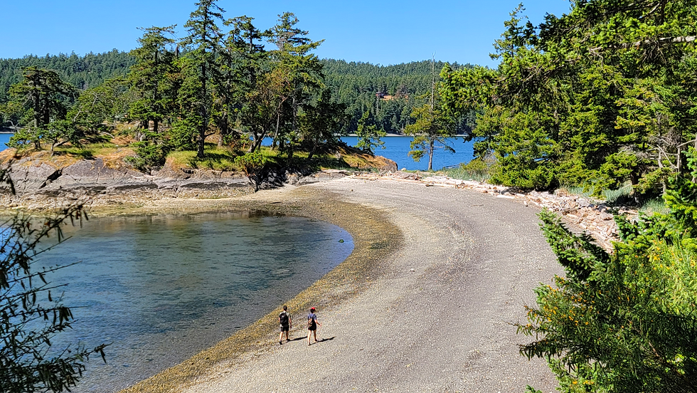
Stanley Point Road winds up and down along the North Pender Island ocean shoreline past several spectacular homes. The primarily undeveloped property on the right side of the road is privately owned up to Walden Road. A sign on the corner with a little cedar-shake roof leads you to George Hill. The Walden Road Ocean Access, marked with a PIPRC signpost, is a short down-and-up, out-and-back trail. When I kayak from Thieves Bay, I land in the tiny cove.
George Hill and the Port Wash area are genuine treasures.

Hidden treasures in George Hill Park.