Around South Pender Island
- Richard Philpot

- Jan 25
- 11 min read
Updated: May 16
Paddling 18 klicks isn’t for the faint of heart. But for those fit and skilled enough to tackle this journey, the rewards are plentiful. On separate trips around South Pender, my “Best of Our Nature” encounters have put me alone in Plumper Sound with Bigg’s orcas, alongside a juvenile Humpback when it surfaced near Blunden Islet, and in the company of Southern Residents in Boundary Pass. And that’s not to underrate recurrent sightings of seals, sea lions, porpoises, otters, herons, eagles, seasonal sea birds, and a fascinating shoreline. Circumnavigating South Pender Island is exhilarating.
Table of Contents
Photographs, videos, audio, and text Copyright © 2026 Richard Philpot/SGIOUTSIDE.ca.

The sandstone shoreline at Tilley Point, South Pender Island. Can you find the green and black hydrophone cables descending into the ocean? (042425)
AROUND SOUTH PENDER
RP’s last time paddled: January 18, 2026
Overview
A challenging outing, mainly because of the distance. It’s best left to physically fit and experienced paddlers. Less proficient paddlers should join forces with someone more competent. Understanding tide and current tables, navigational charts, and wind predictions is necessary to avoid troubling sea conditions in Teece Passage, around Gowlland and Brooks Points, and under the Canal Bridge between North and South Pender Islands. Under favourable conditions, the voyage around South Pender offers your visual palate an excess of nature’s goodies: distant views of neighbouring islands, a close-up look at our diverse ocean shoreline, and abundant marine and bird life. Ensure you allow time to go ashore at Brooks Point Regional Park and Beaumont Marine Park for a picnic or to explore (042425).
Around South Pender Island FACTS
Distances vary with GPS tracker devices and digital mapping software.
Tour Type: Circle tour
Best Time of Year: Spring through fall, but summer’s low tides result in the most interesting intertidal and wildlife
Difficulty Rating: CHALLENGING (due to the distance)
Distance (Garmin): 18 km (approx. 10 nmi/11 miles)
Time Allowance: 5 hours (add another 1-2 hrs if making multiple stops or lunching at Brooks Point Regional Park, Poets Cove Resort & Spa, or Beaumont Marine Park)
Tides: Bedwell Hbr – 7 Day/Hourly Tides (Fisheries and Oceans Canada); CHS Nautical Chart 3477
Wind Predictions: Windy.com
Dangers: Powered boats in Teece Passage, arriving at Poets Cove Resort & Spa, and under the Canal Bridge between North and South Pender; tide- and ocean freighter-caused turbulent and fast-moving water in Teece Passage, around Gowlland and Brooks Points, and under the Canal Bridge between North and South Pender Islands
Services Along Route: Mortimer Spit beach, picnic table, and outhouse (near Canal Road); bathroom and walking trails at Brooks Point Regional Park; bathrooms, gift shop, restaurant and bar, coffee bar, and wine and beer store at Poets Cove Resort & Spa; Parks Canada information stations (NO camping), hiking trails, and outhouses at Beaumont Marine Park (GINPR)
Freshwater Availability: Poets Cove Resort & Spa
Birders: Brooks Point Regional Park—151 species since 1984 (eBird); Beaumont Marine Park—75 species since 2019 (eBird)
Launch and Parking: Mortimer Spit, South Pender Island
Travelling to the Launch: By vehicle—3.8 km from Driftwood Centre, south on Bedwell Harbour Road (mislabeled on Google Maps as Canal Road), left turn on Canal Road, left on the South Pender side of the Canal Bridge, left turn to Mortimer Spit just past the Canada Post mailboxes)
Launch Coordinates (Mortimer Spit): 48.76708, -123.25814

But for the ROUGH ROAD, Mortimer Spit is the ideal launch site (042425).
Route Description
Launching and Landing: Mortimer Spit, South Pender Island
Mortimer Spit to Teece Point
Beware of the yawning potholes on Mortimer Spit. It’s why I park my low-clearance Toyota Prius by the CAUTION ROUGH ROAD DRIVE SLOWLY sign near the start of the Spit’s gravel road. The bumps have the potential to cause undercarriage damage to vehicles like mine. According to PIPRC, filling and grading the road aren’t options at this time.
Trucks and SUVs are best parked and unloaded at the Spit’s point, where, facing the bridge, kayakers can seal launch into protected Shark Cove. Mortimer Spit is another of the Penders’ off-leash dog play spots.
I prefer circumnavigating South Pender clockwise to make my final stop at Poets Cove Resort & Spa or the Gulf Islands National Park Reserve’s Beaumont Marine Park. Your choice of direction should be dictated by wind direction and strength, and Bedwell Harbour tides/currents. Remember to factor in the current flow through the canal and under the Canal Bridge, which can reach five knots (over nine km/h). You don’t want the current impeding you. Ideally, you’d arrive at a zero tide with a weak, helping current. Low tide unveils fascinating intertidal life on both sides of the canal and a Great Blue heron or two foraging in the shallows.
N.B. Recently, support post cross-bracing has been added to the Canal Bridge. These structural improvements have eliminated a paddler’s option to hug the shoreline when passing under the bridge.
The first segment of a clockwise trip around South Pender is more or less a seven-kilometre straight shot southeast to Teece Point; plenty of time to acquire your paddling rhythm. You’re wise to stay offshore a short way to avoid rocks lurking just below the ocean surface, ready to grab your hull or paddle blade. Apart from beautiful oceanfront homes, there isn’t much to see before exiting Browning Harbour. Past Razor Point, the view expands (left to right): the south end of Mayne Island, all of Samuel Island, Saturna Island’s partially treeless humps, and, in the distance, the US San Juan Islands. You can see Mount Norman from here, South Pender’s highest peak.
The first rest or relief (urinary) beach is a few kilometres into your journey, just before the gorgeous navy blue, cedar-shake-clad house with white trim. It’s one of the rare properties on the Penders where the owner can drive from their high-bank house to sea level.
Things get more interesting from here to Teece Point. Look left to see Saturna Island’s long-ago clear-cut Brown Ridge on Mount Warburton Pike. Yes, visitors can walk the ridge. Paddlers can land at Thomson Park or Bruce Bight Beach and climb to Brown Ridge’s trails.
South Pender’s historic log-and-tin-roofed Walker House (1910) is next, followed by a newer log house with a green metal roof, where barnacle-covered underwater rocks await the paddler who’s not paying attention. And take a wide berth around the next point jutting into Plumper Sound, marked by a tree-hidden, box-shaped house of mostly windows (the perfect home for a writer, painter, or musician). A rocky beach (another rest or pee spot) and PIPRC’s Ancia Road Ocean Access are tucked behind the headland. This would be a great launch location for a trip to Saturna if it didn’t require maneuvering your paddle craft down and up a long, narrow, and steep staircase.
From here to Teece Point, you’ll find other gravel beaches, various outdoor furniture arrangements, a Canadian flag near the water’s edge, and other trail accesses, including Boundary Pass Drive Ocean Access, which faces a boxy rock outcrop usually occupied by gulls or cormorants and a rock garden supporting hauled-out Pacific harbour seals.

Shorebirds gathered in the rock garden near Teece Point, with Saturna Island’s Brown Ridge as the backdrop, visible above marine fog (110220).
Through Teece Passage to Brooks Point
On a clear day, the north-to-south vista before entering Teece Passage is Taylor Point and Monarch Head on Saturna; Pecos, Waldron, and Orcas Islands in the United States; and Blunden Islet (metres from Teece Point). The tallest snow-capped mountain peak furthest away is Washington State’s Mount Baker, which is covered in white stuff throughout the year. Blunden Islet was deemed off-limits to humans when absorbed by the Gulf Islands National Park Reserve (GINPR). A trip around the islet reveals seals, Black oystercatchers, and other shorebirds, and at its highest elevation, Bald eagles perched on one of the few trees and a variety of wildflowers. Before the GINPR, Blunden Islet was a favoured camping spot for kayakers willing to haul their gear to the top of the isolated rock.
The ocean state can be confused and speedy between Teece Point and Blunden Islet. If the current flow is favourable, take the centre of the channel for a quick ride. More often than not, I paddle through the Bull kelp closest to Teece Point; skittish seals are sometimes hiding in the kelp’s buoyant bulbs and mass of blades. The most pressing danger in Teece Passage is boat traffic. Operators under power rarely respect paddlers’ presence, adding turbulence to what otherwise would be quiet water. You’re safe and sound when entering South Pender’s Camp Bay.
Many paddlers skip venturing into Camp Bay. Their loss. It’s hard to imagine owning six-hundred-metre-long Teece Point. Great Blue herons frequent the trees on Camp Bay’s north side, and seals commonly haul out on exposed rocks near the head of the bay. During the past 22 years, I’ve never seen people on the beach or the three shoreline properties. The easily accessible south end of the beach is a nice go-ashore spot.
Some label the spike of land leaving Camp Bay as Eagle Point. Accurate or not, Bald eagles regularly occupy a tree. South Pender friends call the rock outcrop across from the point Eagle Rock. I’ve witnessed adult and immature Bald eagles “guarding” the location with dozens of seals lying on sea-level ledges. The newly upgraded, solar-powered, all-white, fixed Gowlland Point maritime navigation light is in sight, just past Gowlland Point Beach. You can stretch your legs and picnic at Brooks Point Regional Park in ten minutes. Frequently, a lone heron clings to a Bull kelp stipe, watching paddlers rounding Gowlland Point. Eddies and overfalls can present a paddling challenge as you pass the point and the park.

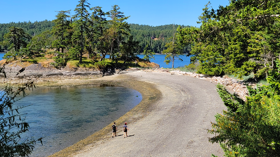
On land at Brooks Point Regional Park. Time for nourishment and a stroll out to Gowlland Point. On a clear day, Mount Baker might be visible (031719).
(The photograph was taken before the Canadian Coast Guard replaced the Gowlland Point navigation light.)
Brooks Point to Bedwell Harbour
Back in or on your paddle craft after rest, food, and some park exploring, your route passes a pockmarked conglomerate rock wall that drops into the sea. On several occasions, friends and I have stood above Southern Resident orcas swimming by within metres of shore. The thrill never gets old. Sadly, the orcas’ visits have been far less frequent in the past 15 years.
If the tide height allows, venture into Drummond Bay between the rock outcrop and shore for a better view of the beach, where you can expect eagle, heron, and seal sightings. Exiting the bay at Higgs Road, the shoreline wall grows, and you lose sight of the oceanfront residences until you get closer to Craddock Beach. Look for the newly built home on Southlands Drivefront; the deck extends precariously beyond its cliff supports. They have an exceptional view of Stuart Island across the invisible Canada-US border in Boundary Pass.
Rather than stopping at Craddock Beach, wait a few minutes longer for the crescent-shaped pebble beach at Tilley Point. Somewhere between and offshore of the two beaches, experienced scuba divers can explore an underwater cave and tunnel and a plethora of marine life inhabitants (see naturediver.com).
Eagle-eyed paddlers watching Tilley Point’s sandstone bluff will see green and black cables descending from the lone house on the property into the ocean. The cables connect a hydrophone to a network array deployed by Canada’s DFO at least a decade ago to listen to orcas in the region. Several Pender friends played key roles in locating the device at Tilley Point with Harald Yurk.
Read Yurk and co-author’s 2023 study publication: Evaluating the effectiveness of shore cabled hydrophone networks as near real-time killer whale detection and tracking systems with special reference to DFO’s Whale Tracking Network (WTN). While you can’t listen to the WTN, you can listen for and watch for orcas via Raincoast.org’s Pender Whale Sanctuary Underwater Listening Station.
Small beaches on the northwest side of Tilley Point and at the next curve in the South Pender shoreline aren’t worth a look unless you need “relief.” However, what deserves a gander is only a few strokes away. The Stairway to Heaven is an extraordinary design and building feat. I asked one of the owners if they’d ever counted the stairs from top to bottom. “Yes.” Unfortunately, I can’t recall the tally; maybe 250 steps. Did she say the small building at the bottom is a refreshment bar? I can’t remember that either.
A glance west and north offers a view of Moresby and Salt Spring Islands and, in the foreground, Wallace Point on North Pender. You’ll pass other long, twisting and turning staircases between here and Bedwell Harbour. Aim your bow at a massive rock featuring three or four Juniper bushes on top. At a high enough tide, you can skirt the monolith with metres. The red and white maritime navigation light at Hay Point is your next visual aid before turning north and passing Coast Salish reserve land, this side of Poets Cove Resort & Spa.
Stairway to Heaven

Could this construction triumph have inspired Led Zeppelin lead singer Robert Plant’s Stairway to Heaven lyrics? Who could survive scaling these stairs after a couple of drinks?
Beware of Irresponsible Powerboaters.
Significant powered-vessel traffic arrives at and departs from Poets Cove Resort & Spa or travels through Bedwell Harbour between the Penders on weekends and in summer. Pay close attention. Human-powered paddle craft are no match for larger, fast-moving vessels. Even if your non-powered vessel had the legal right of way, it’s of little consequence in a collision. Take evasive action if you appear to be on a crash course—slow down, adjust your heading, and if necessary, sound your whistle and wave a paddle blade. Look for a sign that the other boat has seen you and changed its direction.
Poets Cove to Beaumont Marine Park
Poets Cove Resort & Spa’s oceanfront pub and patio—Syrens Bistro & Lounge—is a terrific spot for lunch. It’s barely a stone’s throw from landing on the beach. The tide height will determine whether you can paddle under the Poets Cove Marina gangway after your meal and follow the shoreline to the Gulf Islands National Park Reserve’s Beaumont Marine Park (read “Tug-ged” down to the beach).
Beaumont Marine Park’s dozen mooring buoys will be occupied in summer, and other boats will be at anchor. Snuggle up to the shoreline to avoid the boaters and possibly see the River otter clan, who make their home in the rocks. Great Blue herons, gulls, and seals are active on and around Skull Islet to the southwest.
There are three landing site options in the park. The first is a narrow beach, which, until 2025, had a wooden staircase connecting boaters with the Beaumont trail system. There’s no word yet on whether Parks Canada will replace the stairs. The second and third landing sites are further west on each side of the Beaumont Peninsula and can be muddy at the lowest tides. The main crescent beach is beautiful, the perfect place to re-nourish and hydrate in preparation for the remainder of your journey.

The more sheltered beach on the west side of Beaumont Peninsula (110220).
Beaumont Marine Park to Mortimer Spit
The remaining shoreline of the marine park is very pleasant. River otters often set a table on the rocks to eat their catch or have fun skimming down an earth slide into the sea. (I’ve seen a couple mating in the area). Great Blue herons, Bald eagles, and cormorants are regularly sighted in this stretch, and when the water’s low, so are tons of sea stars (Ochre, Leather, Bat, and Pacific Blood stars).
At Ainslie Point, green and red pillar buoys mark safe passage through the narrow channel and under the Canal Road Bridge separating North and South Pender Islands. These lateral buoys help powered boats avoid hazardous obstacles. Take care when entering the path defined by the buoys—to prevent a too-close encounter with vessels in the confined waterway.
Paddlers should stick to the South Pender shoreline for safety reasons and because of the intertidal life. Tides near zero expose a Rough piddock colony in the clay bank below the multi-window cedar house. Great Blue herons hunt prey in the shallows.
It’s time to skipper your vessel under the Canal Bridge, the narrowest gap between the Penders. Look fore and aft for powerboats before proceeding. Paddle in place until the scene is clear ahead and behind, then cautiously make your way between the bridge’s mussel-and-sea star-laden support posts. Cross beams bolted to the posts block alternate nearshore routes under the bridge.
Signs on the bridge state that the maximum current can reach 5 knots (10 km/h). That’s fast-moving water. And why it’s critical to plan your trip direction and timing after consulting the Bedwell Harbour tide charts. Aside from safety, quiet water in the canal gives time to spy on the underwater Orche stars, anemones, sea cucumbers, and Red Rock grabs.
You’re back at the Spit, tired and happy. Way to go.

New cross-bracing between the support posts makes nearshore passage under the Canal Bridge more challenging than before the structural improvements (042825).